Across BIO INTEL MOB, partners are moving from identifying possible locations for Peri Urban Mobility Hubs to examining which sites can support their planned interventions. The work is taking place across the project’s Mega Pilots and Satellite Sites, with partners looking at existing transport connections, mobility demand, available space, land and infrastructure conditions, accessibility, regulatory requirements and the information still needed before a location can move towards detailed design.
The assessment is not the same in every pilot. Some partners are comparing a defined set of candidate sites, while others are working from mobility corridors, larger geographical areas or a much wider pool of potential locations. The current work also shows how much information is needed before a PUMH location can be taken forward, from transport flows and public transport connections to ownership, utilities, permissions and the conditions for future operation.
Rome
In Rome, five locations are currently being verified for the implementation of Peri Urban Mobility Hubs. The sites are connected to existing public transport services, including Line B, Line A and Line C, with locations inside stations or close to existing terminals.
The Rome team is going beyond identifying the sites. Its assessment looks at whether there is suitable physical space for adaptable interventions such as modular charging and bike boxes, as well as proximity to major public transport networks. Baseline data modelling is being used to examine mobility flows, logistics demand and safety conditions for vulnerable road users. The mobilisation work is already complete for the census of existing transport services, cycling and pedestrian accessibility, passenger transport corridors and visual documentation of the sites. Site verification and the definition of operational capacity are at 80 percent, while catchment area mapping is at 60 percent. Further work is still needed on vulnerable road user safety and passenger and commercial flows
The team is also checking the legal conditions for deployment. This includes determining whether a PUMH would be classified as urban furniture or as a building structure, as well as checking seismic requirements and possible heritage and landscape permissions. The next steps are to confirm the locations with the public administration, complete the remaining data collection and move towards operational deployment scenarios.
Cascais
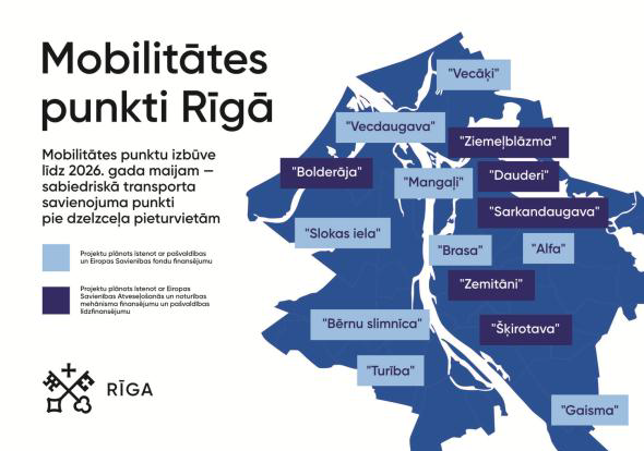
Cascais has followed a structured selection process, with 16 potential sites assessed through a weighted multi criteria matrix. Five locations were shortlisted for further assessment: Mata da Torre at Jardim E Leclerc, Alcoitão on Avenida da República, Alcabideche at Adroana, Trajouce at Grupo Musical e Desportivo 9 de Abril and Matarraque on Avenida Francisca Lindoso. The five locations received scores of 4.41, 4.21, 4.02, 3.94 and 3.87 respectively. The assessment considered intermodality, bicycle integration, road safety, urban regeneration, territorial impact and other criteria.
The locations also represent different situations within Cascais. Mata da Torre is an existing quality public space beside a major commercial hub and can provide a buffer between traffic and vulnerable users. Alcoitão offers an alternative to the EN9 barrier and has potential as a bicycle corridor. Alcabideche is located in a peri urban and rural transition area, while Trajouce has a strong community and associative role. Matarraque could serve as a connection between residential areas and everyday services.
The five sites are now being assessed with the aim of selecting three for detailed design and construction. The team is also working on land ownership and permission requirements, particularly for locations close to the EN9, before moving further into the co design phase.
Riga
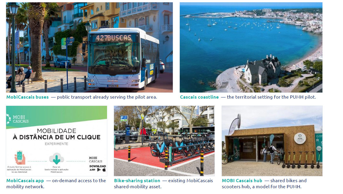
Riga is approaching the selection of PUMH locations through its wider mobility corridors. Five corridors have been identified, linking surrounding areas with the city centre. These include the North Coast corridor connecting Vecāķi, Vecdaugava and Mangaļi with Zemitāni and the city centre, the Ropaži A2 corridor connecting Ulbroka and the Alfa mobility point with the city centre, the Mārupe airport corridor, the Salaspils south east corridor and the Ķekava A7 corridor.
Based on these corridors, potential PUMH locations have been proposed at places including Katlakalns, Piņķi, Ulbroka, Rumbula and Dārziņi and Priedaine, together with several mobility points within Riga. The map prepared by the pilot shows how these locations sit along the identified mobility corridors. The next stage is the assessment of the proposed locations by RPR and the relevant stakeholders.
Riga is also preparing the next steps for co design and data integration. This includes selecting an approach for involving citizens in the design of the PUMHs and contacting data owners to establish access for the aMDS. The project team is also working towards a common kit of parts for modular PUMHs.
Vilnius
Vilnius District Municipality has proposed five candidate PUMH locations: Nemenčinė, Kena, Maišiagala, Pagiriai and Rudamina. The current screening considers public transport, walking, car access, cycling and micromobility, as well as railway connections where relevant. The team is also looking at daily flows, settlement centres, retail and services, transfer points, land availability, visibility, access and the potential for infrastructure such as shelters, bicycle and scooter facilities, information, monitoring and lighting.
The assessment is supported by a municipality site catalogue, GIS screening and evidence questionnaires. Ownership, road corridors, utilities, protection zones and technical conditions are among the issues still being clarified. The project is therefore moving from the initial identification of five locations towards a more detailed comparison of their feasibility.
Urla
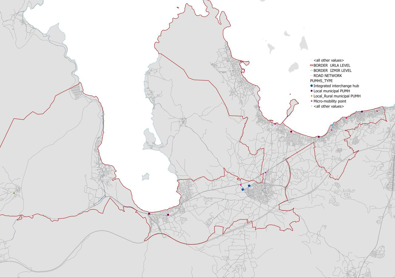
In Urla, the scale of the initial screening is considerably wider. Approximately 35 sites have been screened and around 17 priority candidates have been mapped. The regulatory and spatial groundwork is already in place, including the application of the project methodology, GIS candidate mapping and two possible geofence approaches.
The remaining work is now focused on evidence for individual sites. This includes confirming boundaries, ownership, planning designation, accessibility and demand, as well as the competent authorities involved in approvals. The team will then rank the candidates according to demand, accessibility and multimodal value before selecting the four target PUMH locations. Two geographical approaches are currently available for the operational geofence, at district and neighbourhood level or at peninsula level.
This means that the main challenge at this stage is not establishing a regulatory framework. It is building a sufficiently detailed evidence base for each candidate location so that the final selection can be made.
Ciampino
In Ciampino, the pilot is planning at least three PUMHs in different local contexts. The proposed locations include the central area, a square close to regional train and bus stops and a transition zone between the urban and peri urban areas. The pilot is looking at how these different settings can support safer and more accessible movement for vulnerable road users, multimodal connections and links with logistics solutions such as bioPLU and electric bikes.
The three locations therefore provide different contexts for the planned interventions and will contribute to the project’s work on applying its solutions across different types of urban areas.
Melsungen
Melsungen currently has ten locations in the pre selection for PUMHs. They include a motorhome parking area, the city centre and service centre, the new Stadthalle, a station and supermarket location, the Waldschwimmbad and schools, locations around B. Braun, the Kulturfabrik parking area and a site at the former hospital.
The pilot has also set out ten specific criteria for evaluating these locations. These cover basic site suitability and the availability of traffic data, stakeholder involvement and acceptance, costs, risks, access routes, integration with planned infrastructure measures, flood risk, distance from sensitive uses, social acceptability and compliance with construction and operational regulations.
The Melsungen approach therefore provides a particularly clear example of how the project is moving from a list of possible locations to a structured assessment of whether each site can support implementation.
Rhodes
Rhodes is assessing five candidate sites that represent different mobility situations: a central urban interchange, Faliraki Bus Station and Beach Parking as a tourism related peri urban interchange, Ialysos as a transition zone stop, Hotel Capsis RODA Stop in Ixia as an alternative west coast node and Akantia Port and Municipal Parking as a ferry and city gateway with park and ride potential.
The pilot has defined common targets for connectivity, congestion, vulnerable road user risk and air and noise quality, with the intention of measuring the same indicators before and after implementation.
The site assessment will also look at multimodal transfers, parking occupancy and queues, vulnerable road user conflicts and speed, as well as air quality and noise. This gives the pilot a clear baseline against which changes can later be measured.
From candidate locations to deployment
Across the pilots, the work is now becoming increasingly site specific. Partners are not only identifying possible places for Peri Urban Mobility Hubs, but collecting the evidence needed to understand what can actually be implemented at each location. Public transport connections, mobility flows, accessibility, available land, infrastructure, ownership, utilities, stakeholder support and regulatory conditions are all part of this process.
The different approaches also show the variety of contexts in which the BIO INTEL MOB PUMHs will be developed. Rome is examining locations around established metro and bus networks. Cascais is narrowing 16 sites down to five and then three. Riga is working from mobility corridors. Vilnius is comparing five candidate locations and already has detailed evidence for Nemenčinė. Urla is working through a much wider pool of potential sites, while Melsungen is applying a defined set of ten evaluation criteria to ten candidate locations. Rhodes is looking in detail at different interchange situations, while Ciampino is considering three distinct urban and peri urban contexts.
The next steps will differ from one pilot to another, but the direction is the same: close the remaining evidence gaps, confirm the locations and move the selected sites towards detailed PUMH design and implementation.